
wanderer
Keep all your hiking and cycling routes in one private trail library.
No server needed to start: Cloudgate can provide one. What happens when you click Deploy




What is wanderer?
wanderer is a self-hosted trail database: upload GPS tracks, plan hiking and cycling routes, and share them privately, instead of AllTrails or komoot.
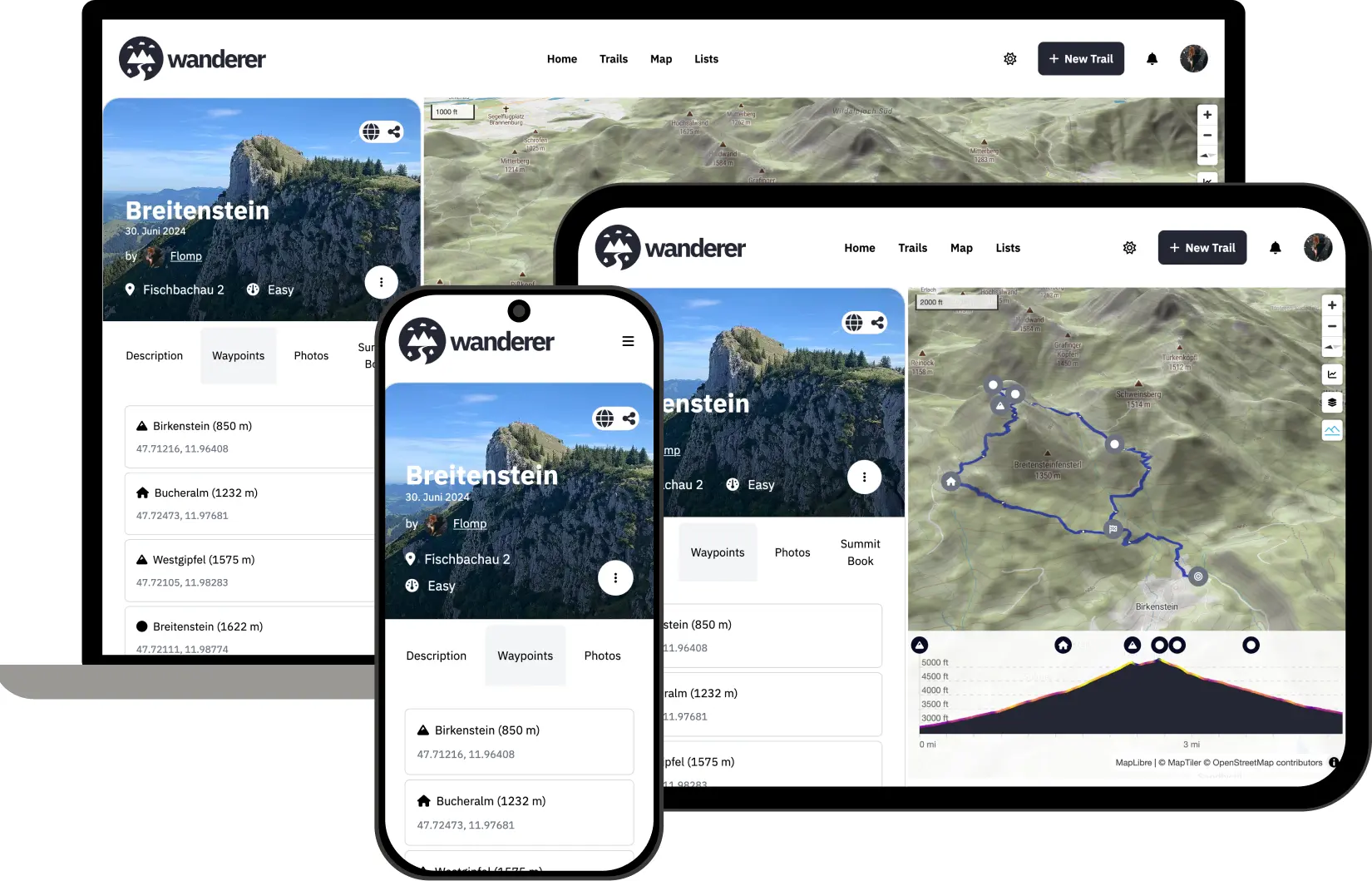
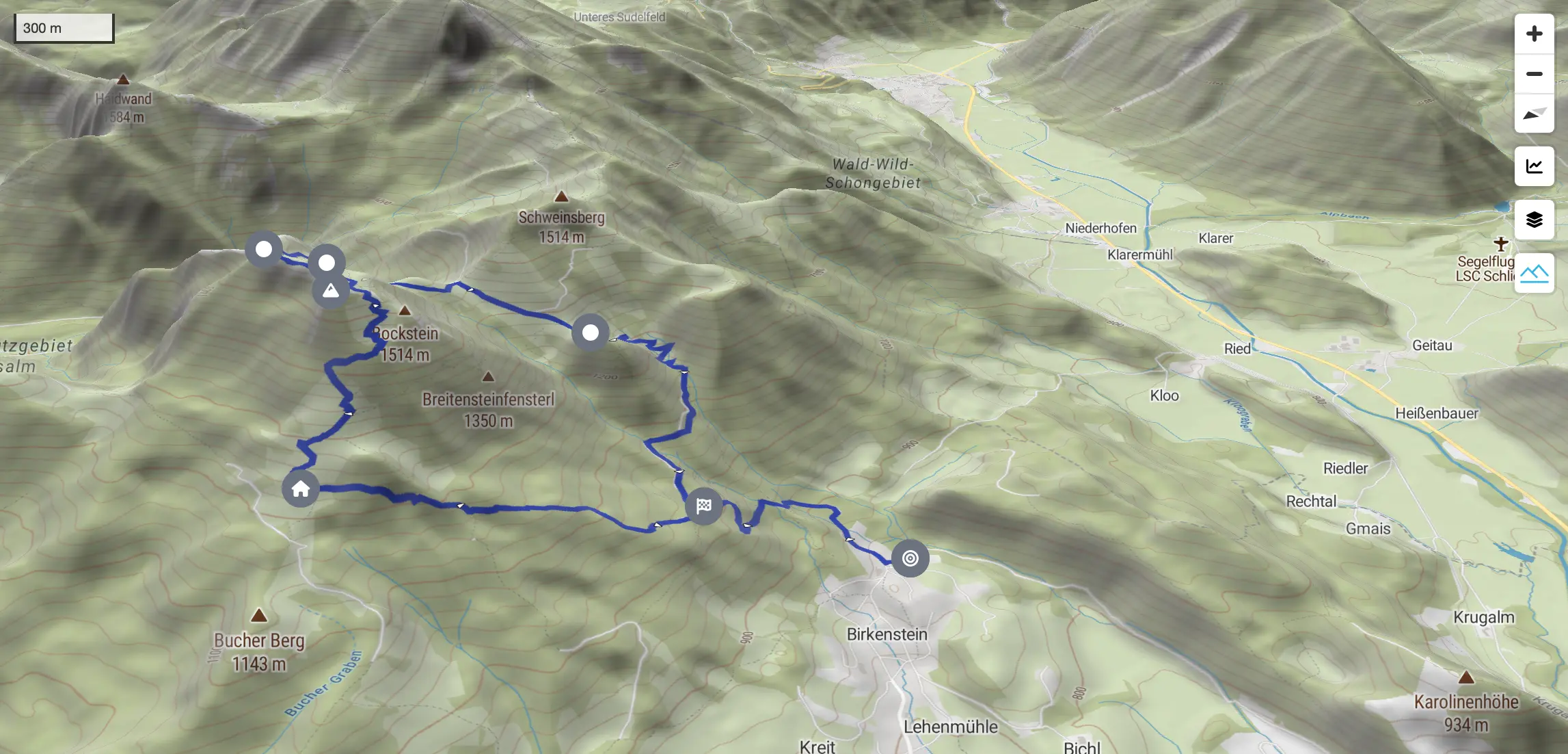
wanderer is a free, open-source, self-hosted trail database: a private alternative to AllTrails and komoot for keeping, planning and sharing your hiking and cycling routes. You upload the GPS tracks you recorded, or draw new routes on the map, and wanderer turns each one into a trail page with a map, an elevation profile, photos, waypoints and notes that you can search.
A small guided-walking business, for example, could keep every route it leads in wanderer, group them into lists such as "Coastal walks" or "Three-day tours", share each one with that week's guide, and publish a few as previews for customers. A walking club could do the same for its members, logging every outing against its trail.
wanderer reads GPX, FIT, TCX and KML files from most watches, bike computers and phone apps, and exports your trails as GPX at any time. Different wanderer servers can follow each other, so members can see trails published elsewhere. It works in any web browser, including on a phone; a phone app is in beta.
Cloudgate installs wanderer on a server Cloudgate provides or one you connect, with its search, and gives it a secure web address. Open it right after install to register your own account, then turn off new sign-ups if the library is just for you or your team.
What you can do with wanderer
- Upload your GPS tracks Add recordings from your watch, bike computer or phone as GPX, FIT, TCX or KML files.
- Plan new routes Draw a route on the map and wanderer follows paths and roads, with distance and climb worked out for you.
- Build a page for every trail Add a description, difficulty, photos, waypoints and an elevation profile.
- Search and filter Find trails by name, place, length, climb or category, or browse them on the map.
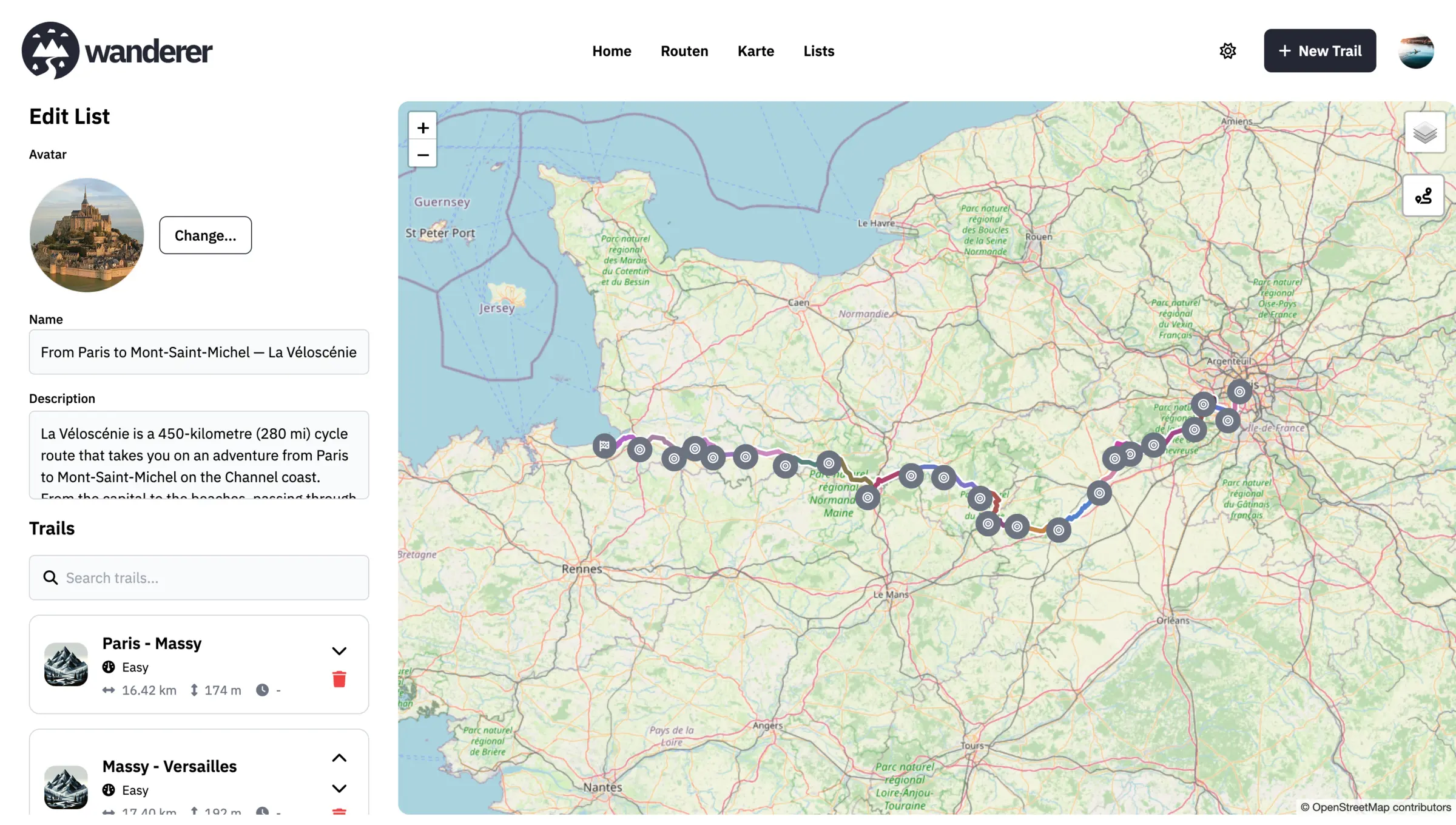
- Group trails into lists Collect the stages of a long-distance route or a season's outings and see them together on one map.
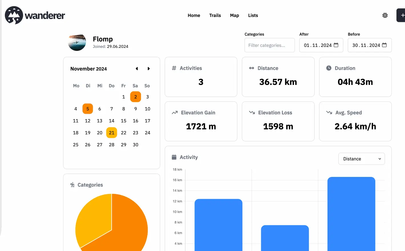
- Log every outing Record each time a trail was walked or ridden, with the date, photos and notes, and see your totals in statistics.
- Share on your terms Keep a trail private, share it with chosen people to view or edit, or publish it for anyone to see.
- Export any time Download your trails as GPX or GeoJSON files, with their photos, whenever you like.
Replaces AllTrails and komoot
wanderer does the same job as AllTrails and komoot. Here is what changes when you switch.
- Every feature is free, with no premium plan or map pack to buy
- Your tracks and photos stay on your own server, not in someone else's account
- Share routes privately with a club or group, with view or edit rights
- Export everything in standard GPS file formats at any time
- There is no ready-made catalogue of other people's trails; you upload or plan your own
- The phone app is still in beta and needs extra server setup, so you use the website in your phone's browser
- Recording a hike live and turn-by-turn navigation need the phone app, so record with your usual app and upload the file afterwards
- wanderer is a young project that changes quickly, so keep a backup of your trails
What happens when you click Deploy?
You do not need a server or any technical knowledge. Four steps, and wanderer is running at its own web address.
- Step 1 Click Deploy and create your account
Deploy takes you to Cloudgate. Create an account, or log in if you have one. wanderer itself is free.
- Step 2 Choose a server
No server? Get one from Cloudgate: pick a size and a country, and Cloudgate gets it ready. Already have one? Connect it instead.
- Step 3 Cloudgate sets up wanderer
It prepares the server, makes the passwords the app needs and starts it. There is nothing to install and nothing to write down.
- Step 4 Open your app and sign in
Your app gets a free web address to start, without https. Add your own domain, like app.yourshop.com, and Cloudgate secures it with https for you.
New to Cloudgate? See what Cloudgate is
Run Cloudgate yourself? Deploy from your own console
In your Cloudgate console, open Templates and choose wanderer.
Questions
Is wanderer free?
Yes. wanderer is free, open-source software under the AGPL-3.0 licence, and every feature is included with no paid tier. You pay only for the server it runs on.
Is wanderer a good alternative to AllTrails?
Yes, if you want your own trail library. wanderer stores, plans, searches and shares your GPS tracks much like AllTrails, without a subscription. Unlike AllTrails, it does not come with a catalogue of trails written by other people; you add your own.
Can I bring my trails into wanderer from komoot or AllTrails?
Partly. Any trail you can download as a GPX or KML file can be uploaded to wanderer. wanderer also has a komoot sync add-on, but it is not included in this template and has to be added to the server separately.
Does wanderer have a phone app?
Yes, but it is in public beta and needs a special server build that this template does not install yet. The wanderer website works in your phone's browser, so you can look up trails, plan routes and upload files on the go.
How do I sign in to wanderer the first time?
Open wanderer's web address and register with a username, email and password; there is no default login. Do it right after install, because anyone with the address can register until you turn off new sign-ups in the template's settings.
Is my trail data private with wanderer?
Yes. wanderer stores your tracks, photos and notes on your own server, and trails are private until you share or publish them. Route planning and place search use public OpenStreetMap services, which see the map points you ask about.
Do I need technical skills to run wanderer?
No. Click Deploy, create your Cloudgate account and choose a server, and Cloudgate sets up wanderer and gives it a web address. You use it in your browser like any other online tool.
Do I need my own server for wanderer?
No. When you deploy wanderer, hosted Cloudgate can provide a server. If you already rent one, you can connect it instead.
Can I move my data from AllTrails to wanderer?
Most people export from AllTrails and import into wanderer. The official guides at wanderer.to walk through it.
Related apps

A self-hosted travel tracker, trip planner and world map in one.

A self-hosted flight tracker for every flight you take, on one map.

A self-hosted baby tracker the whole family can share.

A self-hosted habit tracker with daily ticks and streaks, no goals.