
Open-source alternative to komoot

wanderer is a free, open-source komoot alternative for planning routes and keeping a library of your hikes and rides, with photos, notes, statistics and sharing, on your own server. komoot sells map regions and a Premium subscription for worldwide maps; wanderer has no paid features, though its web app has no turn-by-turn navigation or offline maps.

Free app Code: Open source Import from komoot: Partly Easy

Why look for an alternative to komoot?

komoot is a hosted route planner for hiking, cycling and running, with turn-by-turn navigation in its phone app. The basic map and planner are free; maps of more regions are bought one region at a time, and a Premium subscription adds worldwide maps and extras such as weather on your route.

People look for an alternative when they want their routes and tours kept on their own server, or want to plan and share routes with a club without paying for regions or a subscription. A self-hosted wanderer plans routes, keeps a searchable library of your trails with photos and statistics, and shares them with a group, though it leaves navigation on the trail to your GPS device or another app.

How wanderer compares

Keep all your hiking and cycling routes in one private trail library.

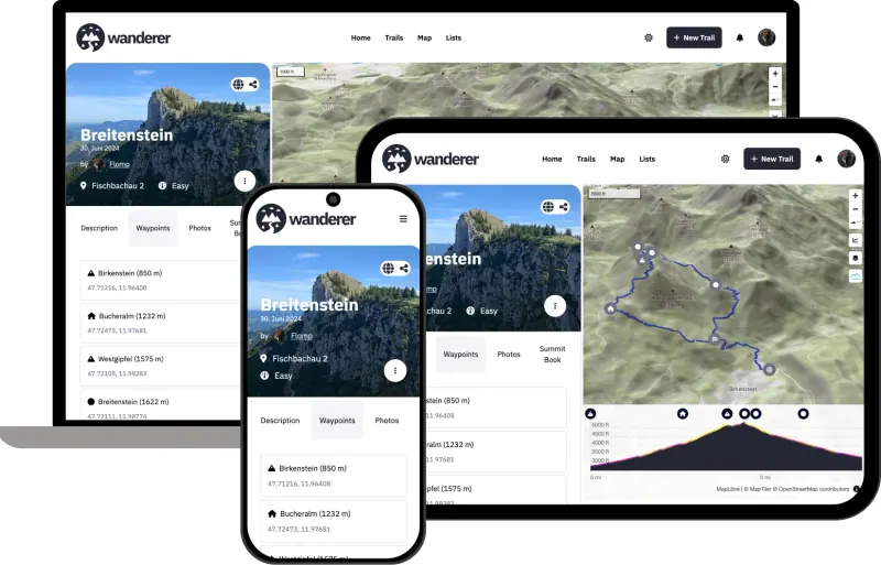
Plans routes on an OpenStreetMap map and keeps them as trail pages with photos, notes, elevation and statistics, which you can search and share with a group, much like komoot's web planner. Its web app has no turn-by-turn navigation, no offline maps and no route recording; those need its phone app, still in beta and not set up by this template.
Easy Open source

Moving from komoot

Export your planned and recorded tours from komoot as GPX files and upload them to wanderer, which reads GPX and KML; it has no direct komoot import. A komoot sync add-on also exists, but it is not part of this template and must be added to the server separately. Once your tours are in, gather them into lists, add photos and notes, and share them with the people you ride or hike with. For navigation on the trail, send the GPX file to your GPS device or phone app.

Questions

What is the best open-source alternative to komoot?

wanderer is the free, open-source alternative to komoot for planning hiking and cycling routes in the catalogue today. Plans routes on an OpenStreetMap map and keeps them as trail pages with photos, notes, elevation and statistics, which you can search and share with a group, much like komoot's web planner. Its web app has no turn-by-turn navigation, no offline maps and no route recording; those need its phone app, still in beta and not set up by this template.

Can I bring my komoot tours into wanderer?

Partly. Download each tour as a GPX file from komoot and upload it to wanderer. wanderer also has a komoot sync add-on, but it is not included in this template.

Does wanderer have turn-by-turn navigation like komoot?

Not in the web app. Plan the route in wanderer, then download the GPX file to a GPS device or a navigation app.

Does wanderer charge for maps of other regions?

No. wanderer uses OpenStreetMap maps for everywhere, with no regions to buy, and every feature is free.

Is wanderer really free compared with komoot?

Yes, wanderer is free. To run them you need Cloudgate and a server. Use hosted Cloudgate, which can also provide the server, or install Cloudgate on a server of your own for free. Cloudgate's plans and prices are at cloudgate.octabyte.io/pricing. One server can run several apps.

Do I need a developer to replace komoot?

No. Cloudgate installs wanderer on your server and gives it a secure web address, and you use it in your browser instead of komoot.